
Geography of the Philippines: Interesting Facts and Information
Ranking as the 5th largest island country in the world, the Philippines comprises approximately 7,600 islands. This beautiful string of islands lies in the southeast part of Asia, between the Pacific Ocean and the South China Sea.
Only around one-third of the country is permanently inhabited by around 113 million people in 2023. Its geographic location is an ideal refuge for over 200 species of orchids, mammals, and birds.
Find exciting travel facts about the Philippines,and discover how this beautiful country faces political, economic, environmental, and social challenges from its unique geographical location.

What are the Three Major Island Groups in the Philippines?
Planning to travel around the Philippines? You should know that its geographical location makes your journey challenging, but fun and thrilling.
The Philippines comprises 3 major island groups – Luzon, Mindanao, and Visayas (arranged from largest to smallest group). Each of these island groups has its own capital for commerce and governance. Now, here’s the kicker.
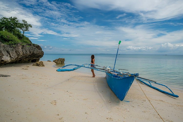
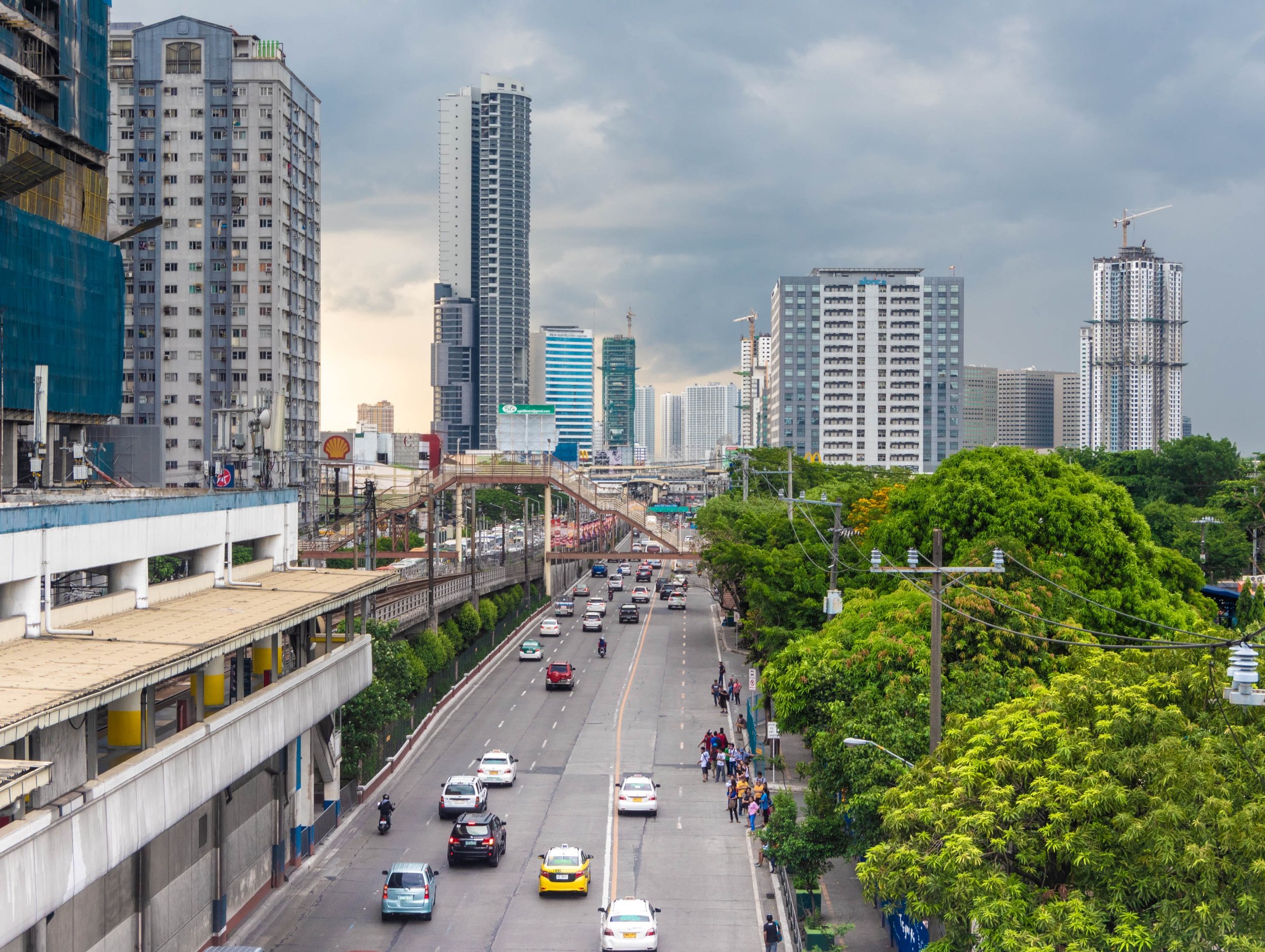
Luzon beautifully sits in the northern part of the Philippines. It is where Metro Manila, the capital of the country, is located.
Listed here are the best tourist spots in Luzon that you can travel to and explore.
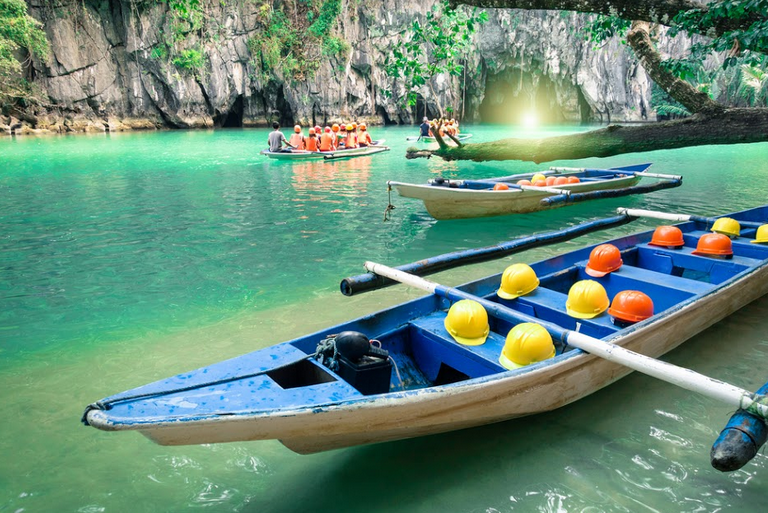
Explore the Natural Wonders of Puerto Princesa
Sagada Travel Guide
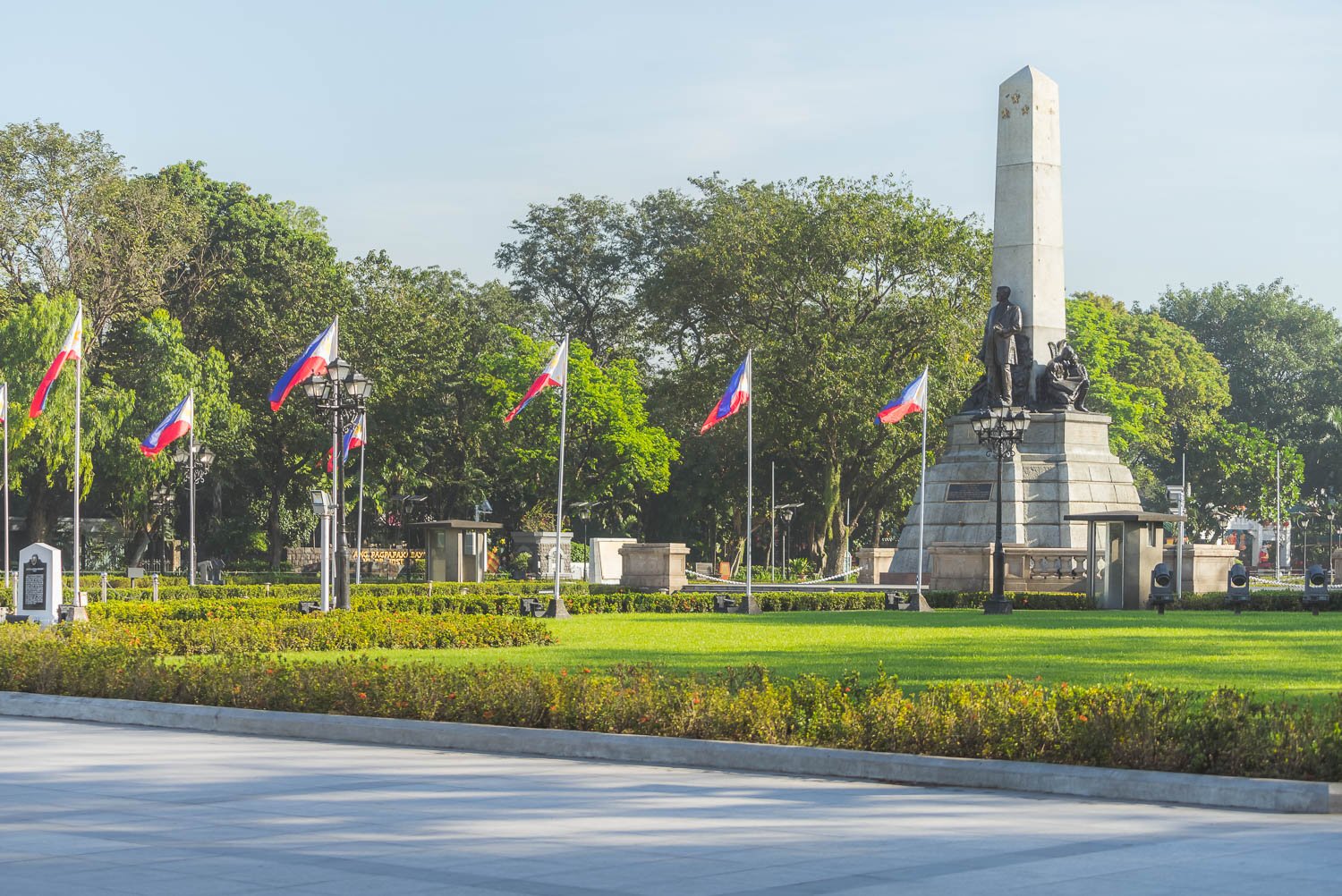
Travel Guide to Manila
Situated in the southern part of the country, Mindanao takes pride of Davao City as its center for commerce and trade. Pay a visit to the Northeastern coast of Mindanao, and get stunned by the beauty of Siargao Island, the “Surfing Capital of the Philippines”.
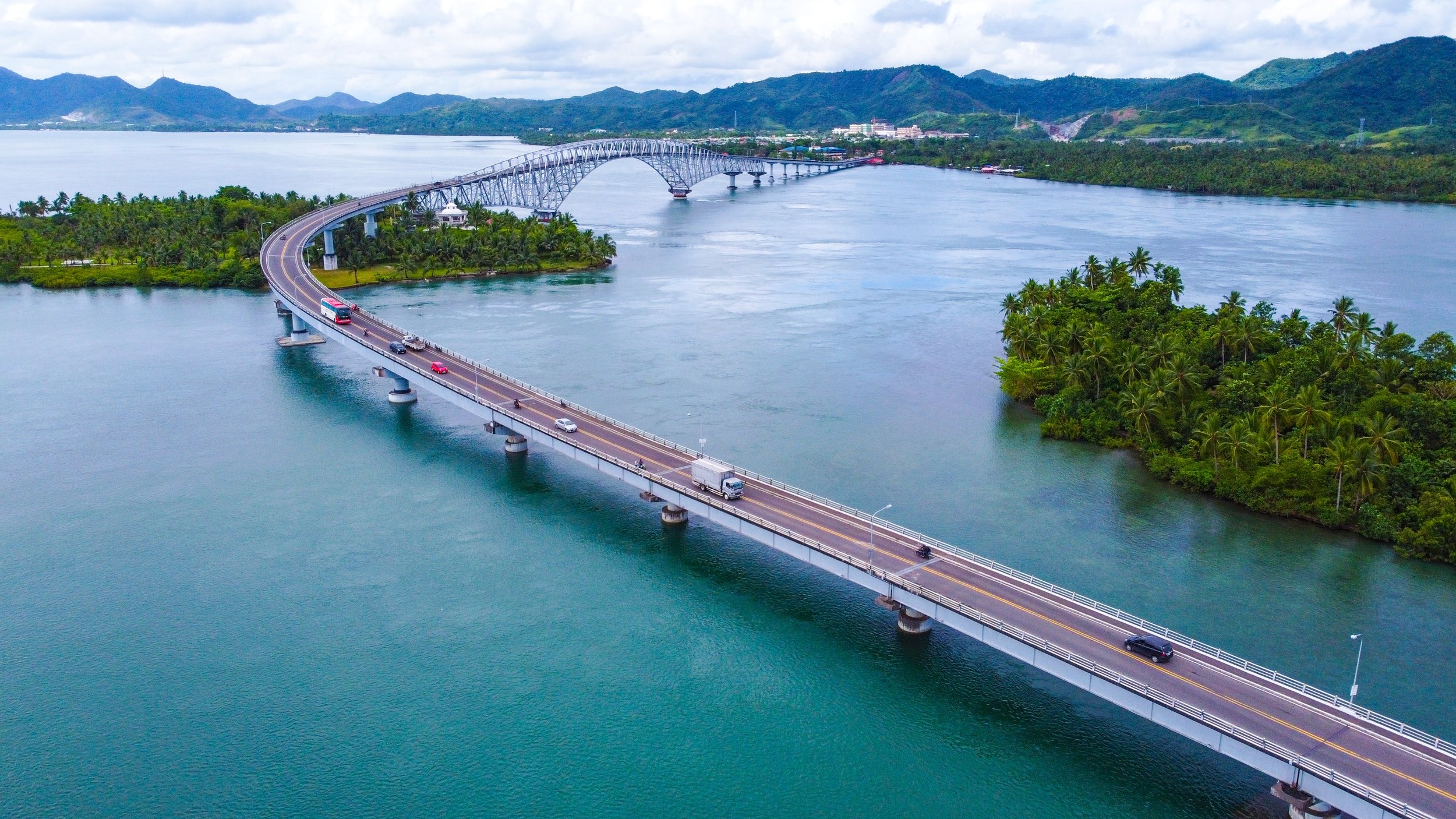
Did you know that out of 7,600 islands in the Philippines, around 2,000 islands are permanently inhabited? It is surprising to hear that there are still more or less 5,000 unexplored and uninhabited islands in the country. Its coastline spans at approximately 36,000 kilometers, and a 300,000 square kilometer total land area. Here is an overview of Philippines Maps.
On the other hand, Visayas has Cebu City as its capital. It is the heart of education, trade, commerce, and industry in the region. Cebu was the country’s first capital city during the Spanish colonization in the 1500s. Check out the must-travel tourist spots in Visayas.
Know more about the things that make traveling in the Philippines memorable.
What are the Administrative Divisions in the Philippines?
In the Philippines, the 4 levels of administrative divisions are commonly known as the Local Government Units (LGUs). It consists of provinces, cities and municipalities, and barangays.
A barangay is a Filipino term for district, village, or ward, and is the smallest administrative unit. Now, if you’re wondering how these highest to the lowest divisions work, pay close attention to the detailed elaboration below.
-
The Philippines is subdivided into 17 regions. The main purpose is to organize, plan and coordinate across different local government units or (LGUs), so that all national government services are efficiently implemented throughout the country.
The Bangsamoro Autonomous Region in Muslim Mindanao (BARMM) is composed of 7 predominantly Muslim provinces, namely Basilan (except Isabela), Sulu, Maguindanao del Norte, Maguindanao del Sur, Lanao del Sur, Tawi-Tawi and Cotabato City. Take note that BARMM is the only autonomous region that has its own political power.
-
There are 82 provinces making up the country. As the largest local administrative unit, these provinces are both political and administrative divisions. This means that leaders (which locals call as Governors and Vice-Governors) are elected by the people.
-
The archipelago is composed of 145 chartered cities and 1,493 municipalities. Each of the cities and municipalities is headed by a Mayor and a Vice-Mayor, who are the elected chief executives of the city government. They hold their official duties in the city or municipal hall.
The City Hall serves as the administration building of the city officials, while the Municipal Hall (also called ‘Munisipyo’ or ‘Kapitolyo’) is where the municipal chief executives perform their administrative responsibilities. Also known as towns, the municipalities can create their own policies and regulations – similar to cities.
-
Also termed as barrio, a barangay is the smallest administrative division in the country. There are 42,046 barangays all over the Philippines. Each barangay has its own elected Barangay Captain, Barangay councilors, and youth council or Sangguniang Kabataan.
The word “barangay” took its name from ‘balangay’, a Malay term referring to sailboats. Traditionally, locals in the Philippines call coastal communities as barangays. But, during the Spanish regime, it was changed to “barrio” which means neighborhood.
Here’s another thing. Even before the pre-colonial era in the country, people lived together under the authority of a chief, or "datu." The Spaniards took advantage of the value placed by Filipinos on the existing administrative system in the Philippines. They influenced the “datu” which eventually gave Spain full control over the islands and its people.
Later, the Spaniards reduced the number of families living in each barrio, resulting in scattered and more compact towns. Learn more about the people of the Philippines and their culture, and discover why the country has a rich blend of traditional Filipino, Spanish Catholic, American, and East Asian influences.
What are the Regions and Provinces in the Philippines?
The 82 provinces in the Philippines have been grouped together into 17 regions. A region is an administrative unit that directly coordinates with the national government as to mandates and regulations. These directives are then passed on to the local government units or LGUs (regions, provinces, cities and municipalities, and barangays) for compliance.
Did you know that each region is identified and designated with a name? It got a number written in Roman numerals too. Regions are much easier to identify by their assigned numbers. Interestingly, some names were taken from the first 2 or 3 letters of the provinces making up the region, just like MiMaRoPa (which stands for Mindoro, Marinduque, Romblon, and Palawan).
Check out their names below.
List of Regions and Provinces in the Philippines
-
CAR – Cordillera Administrative Region
• Provinces of CAR - Abra, Apayao, Benguet, Ifugao, Kalinga, Mountain Province
• Capital City of CAR - Baguio City
NCR – National Capital Region
• There are no provinces in the NCR, only cities and a town. Check out our Manila page to learn more about NCR (also called Metro Manila).
Region I – Ilocos Region Capital City of Central Luzon
• Provinces of Region I - Ilocos Norte, Ilocos Sur, La Union, Pangasinan
• Independent City of Region I - Dagupan City
• Capital City of Ilocos Region - San Fernando (La Union)
Region II – Cagayan Valley Region
• Provinces of Region II - Batanes, Cagayan, Isabela, Nueva Vizcaya, Quirino
• Capital City of Cagayan Valley - Tuguegarao
Region III – Central Luzon Region
• Provinces of Region III - Aurora, Bataan, Bulacan, Nueva Ecija, Pampanga, Tarlac, Zambales
• Capital City of Central Luzon- San Fernando (Pampanga)
Region IV‑A – CALABARZON Region
• Provinces of Region IV‑A - Cavite, Laguna, Batangas, Rizal and Quezon Province
• Highly Urbanized City of Region IV-A: Lucena
• Capital City of CALABARZON - Calamba (Laguna)
Region IV-B - Southwestern Tagalog Region (formerly MIMAROPA Region)
• Provinces of Region IV-B - Occidental Mindoro, Oriental Mindoro, Marinduque, Romblon, and Palawan
• Capital City of MIMAROPA - Calapan (Oriental Mindoro)
Region V – Bicol Region (colloquially known as Bicolandia)
• Provinces of Region V - Albay, Camarines Norte, Camarines Sur, Catanduanes, Masbate, Sorsogon
• Capital City of Bicol Region - Legazpi (Albay)
• Independent Component City- Naga -
Region VI – Western Visayas Region
• Provinces of Region VI- Aklan, Antique, Capiz, Guimaras, Iloilo, and Negros Occidental
• Capital City of Western Visayas - Iloilo City (Panay Island)Region VII – Central Visayas Region
• Provinces of Region VII - Bohol, Cebu, Negros Oriental, Siquijor
• Capital of Central Visayas - Cebu City
Region VIII – Eastern Visayas Region
• Provinces of Region VIII - Biliran, Eastern Samar, Leyte, Northern Samar, Samar, Southern Leyte
• Independent City- Ormoc
• Highly Urbanized City- Tacloban
• Capital City of Eastern Visayas - Tacloban -
Region IX – Zamboanga Peninsula Region
• Provinces of Region IX - Zamboanga del Norte, Zamboanga del Sur, Zamboanga Sibugay
• Cities of Region IX - Dapitan, Dipolog, Isabela, and Pagadian
• Highly Urbanized City - Zamboanga
• Capital City of Zamboanga Peninsula - Pagadian (Zamboanga del Sur)
Region X – Northern Mindanao Region
• Provinces of Region X - Bukidnon, Camiguin, Lanao del Norte, Misamis Occidental, Misamis Oriental
• Capital City of Northern Mindanao - Cagayan de Oro (Misamis Oriental)
Region XI – Davao Region
• Provinces of Region XI - Davao de Oro (formerly Compostela Valley), Davao del Norte, Davao del Sur, Davao Occidental, Davao Oriental
• Capital City of Davao Region - Davao City (Davao del Sur)
Region XII – SOCCSKSARGEN Region
• Provinces of XII - South Cotabato, North Cotabato, Sultan Kudarat, Sarangani and General Santos City
• Capital City of SOCCSKSARGEN - Koronadal (also known as Marbel, located in South Cotabato)
Region XIII – Caraga Region or Caraga Administrative Region
• Provinces of Region XIII - Agusan del Norte, Agusan del Sur, Dinagat Islands, Surigao del Norte, Surigao del Sur
• Capital City of Caraga - Butuan (Agusan del Norte)
BARMM – Bangsamoro Autonomous Region in Muslim Mindanao Region
• Provinces of BARMM - Basilan, Lanao del Sur, Maguindanao, Sulu, Tawi-Tawi
• Capital City of BARMM - Cotabato City
Don’t forget to read about the best travel safety tips when traveling to the Philippines.
What is the Role of Regions in the Philippines?
The main administrative purpose of grouping provinces into regions is the effective implementation of policies and programs of the government. You’ll see the offices of the regional directors of different National government agencies in the region’s capital.
Each province, belonging to a certain region, is governed by an elected local authority referred to as “governor” and the provincial council or Sangguniang Panlalawigan. The 82 provinces in the Philippines are subdivided into component cities and municipalities.
What are the Territorial Disputes in the West Philippine Sea?
The Philippines is the only Southeast Asian country that shares no land borders with its neighbors. Still, it is not free from territorial disputes on the hotly-contested West Philippine Sea.
The 3 disputed islands are the Scarborough Shoal, Spratly Islands, and Paracel Islands. These are located off the coast of western Philippines in the middle of the South China Sea (known by Filipinos as the West Philippine Sea).
Named after Richard Spratly, a British whaling captain who discovered the islands in the 19th century, the Spratly Islands are believed to be a natural gas field. It is abundant in aquatic and fishery resources too. This is the reason why President BongBong Marcos (BBM) plans to push through the Philippine government's joint gas and oil exploration with China in the West Philippine Sea or South China Sea.
Through this government-to-government (G2G) agreement with China, the local pricing of gas and oil in the Philippines can be reduced. If you are keen to know more about the Philippines’ territorial disputes against China, click on the link.
What are Some Interesting Geographical Features of the Philippines?
The Philippines is an archipelago, situated between the South China Sea and the Pacific Ocean. It is mostly mountainous, consisting of small and big islands that are covered with tropical rain forests and pine trees.
Being near to the equator, the Philippines has a tropical climate . This means that it enjoys a weather that is typically hot, humid and wet. The weather in the Philippines can also change very quickly. So, be sure to have an idea of the travel essentials when planning to visit the country.
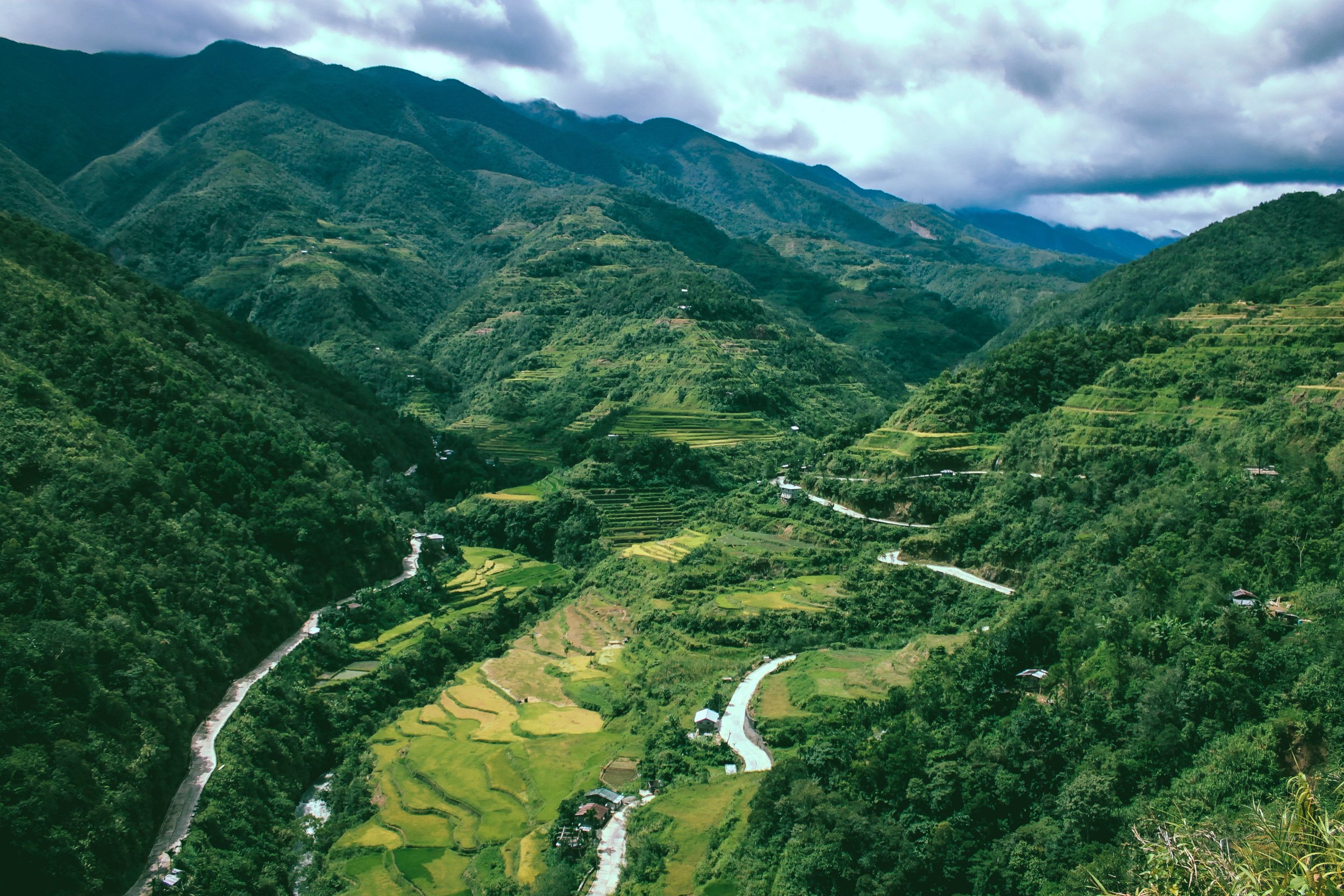
A trip to Baguio City is a perfect start point to the Cordillera Mountains of Northern Luzon.
During the Spanish era, they named the country "Philippines” in honor of King Philip II of Spain. Catholicism was brought by the Spaniards who came to the archipelago in 1521. Since then, religion in the country has an interesting history and background.
Luzon is the Philippines’ largest and most thickly populated island. As a landlocked region, the Cordillera Administrative Region (CAR) is surrounded by mountains. Unlike other popular locations ideal for travel, it has no direct access to the ocean.
It is best to know that the Philippines' location in the Pacific Ring of Fire makes it prone to many earthquakes and volcanic eruptions. This is because of the constant movements and collision of tectonic plates, resulting in the formation of volcanoes and oceanic trenches.
Learn more about the most popular active volcanoes, and the highest mountain climbs in the archipelago.
Aside from its incredible peaks and hills, the country is home to various kinds of natural water forms, such as bays, rivers, lakes, gulfs, and swamps. No wonder why it is one of the world’s top major fish producing countries.
It is rich in natural resources including copper, timber, nickel, petroleum, silver, gold, cobalt, and salt. Go ahead and discover the importance of the mining industry in the country.
Talking about the transportation system, you won’t have a hard time roaming around the country because of the many transfer options available. These include planes, ferries, boats or bancas, buses, cars, and motorbikes.
Our post about the Philippines Transport Travel Guide discusses, in detail, how you can go around and explore the distinct geographical features of the archipelago through these modes of transport.
Summary: Geography of the Philippines
With the country’s stunning landscape, mountainous terrains, dense forests, and coastal areas, you get plenty of first-encounters to try. Activities like surfing, diving, canyoneering, hiking, swimming, and island hopping are must-do. Motorbike tours are becoming popular in many provinces too.
But, the Philippines faces economic and political challenges due to its geographic location. This includes a territorial claim over a portion of the South China Sea or the West Philippine Sea.
If you plan to book a trip to the Philippines, it is recommended to know the best time to travel. Our best accommodations in the Philippines will give you an idea of the different types of lodging to choose from.
Related Posts


